Spatial Selection Tool for use with ArcGIS (ArcView, ArcMap) 2.04
MainStreetSpatial est un plug-in gratuit pour une utilisation avec ArcGIS (ArcView / ArcMap) qui sélectionne fonctionnalités en une seule couche sur la base de leur relation spatiale avec les caractéristiques dans une autre couche. Par exemple, vous...

Logiciels consultés récemment

Apache Commons JCS 13 Apr 15
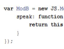
JS.Class 13 May 15

Data Base Scripting Pages 27 Oct 15

TypeScript UI 21 Jan 15

Export Table to Excel for SQL Server Standard 15 Apr 15

SQLData for Oracle to SQL Server 11 Apr 15

HL-DBExporter (Oracle & PostgreSQL) 15 Apr 15

Barcode Scanner ASCII String Decoder 1 Jan 15
-
ActiveX Data Objects (ADO) 1.5/2.0/2.1 SP2 and Visual Basic Sample: Using ADO with an MTS Component via DCOM (Adomts.exe) 21 Sep 15